
August 30, 2017
Terrebonne to Warm Springs (~Mile 2029 on trail)
Pacific Crest Trail Thru-Hike: Day 117
We are on the Deschutes River at the Deschutes River Fly Shop and Campground. After 33 miles through Culver (great town park, creepy town store) and its splash park that Sam finally figured out how to turn on, we had long stints of farmland. An old highway closed to most motor traffic. A roadside gorge with signs for no frisbee-throwing lest your dog jump to get it and fall over the cliff. Private farmland criss-crossed with barbed wire that Google maps told us was open, public land we could walk through.
I slept like shit last night because we basically camped in a ditch and had cars driving by with their headlights on, ready to discover our campspot.
Couldn’t eat lunch, my stomach has been kind of weird all day—some combination of not enough sleep and not enough oxygen.
The section that ended the day was an incredible butte-studded canyon with wild horses and a giant reservoir/lake at the bottom. Just before we dipped below the rim of the canyon we could see Mount Hood crystal clear. Then, after the canyon we jumped right onto Hwy 26 and experienced what it was like to walk on an interstate after nightfall. NOT safe. At. All. It did not set the tone well for tomorrow’s 35-mile highway walk through Warm Springs reservation.
Luckily, I talked to Vice and Boathouse. They said you can get permits to camp on the reservation (or MIGHT be able to get permits), and that they’re easy to get. For now, we have a campsite and have had a very long day, so there’s nothing left to do but sleep and see what tomorrow brings. We are so, so close to the end.

Hazard warnings at Peter Skene Ogden State Scenic Viewpoint

The cliffs… of INSANITY!!!!!!

Sign telling us not to go into the gorge. There were about five other signs that showed rocks falling, winding roads with no shoulder, cars going off bridges, etc.

We went forward despite the warnings and ended up in the gorge walking alongside this enormous, snaking, beautiful lake.
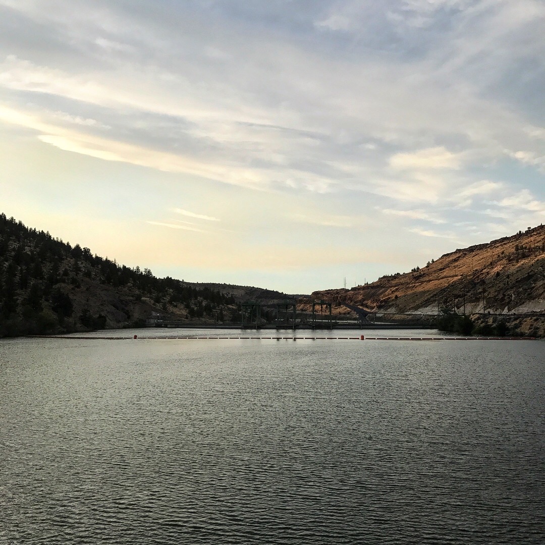
This is where the lake gets sucked through the dam and becomes a river again.

This is not a picture of a dilapidated shack. This is a picture of the beacon of Mt. Hood above/beyond the shack. Obscured by smoke and distance, but still beckoning us to keep on walkin’.

See the outline of the mountain?!

